
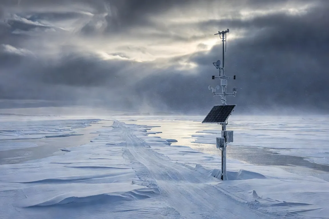
Winter travel across the vast territories of Nunavik and Eeyou Istchee relies on ice roads that form only when sustained sub-zero temperatures allow freshwater and sea ice to thicken sufficiently. Fluctuating temperatures from one winter to the next can shorten or extend the safe operating window considerably, forcing travelers to monitor multiple environmental variables simultaneously rather than relying on a fixed calendar. Connected weather stations increasingly support risk reduction by supplying regular readings of air temperature, wind speed, and precipitation type to regional coordination points. These systems operate alongside traditional visual inspections performed by local crews, and the combination of both tends to catch more emerging hazards than either approach alone. For broader context on regional conditions, readers can consult resources on travel safety in northern Canadian regions.
The climate challenges specific to northern winter travel
Warming trends in recent years have produced more frequent freeze-thaw cycles that can weaken ice sheets even when average daily temperatures remain well below freezing. Such events create surface melt pools that refreeze into thin crusts, masking underlying weaknesses from a casual visual inspection. Wind also redistributes snow cover unevenly, leaving some ice sections exposed to radiative cooling while others remain insulated. Hunters and supply drivers must therefore account for micro-climatic variations that can differ noticeably within a short distance. These conditions make real-time sensor data a genuinely useful complement to traditional knowledge rather than a mere convenience. The state of 4G/5G cellular coverage in Nunavik remains patchy across the region, so many stations transmit via satellite backhaul to ensure data reach communities regardless of local tower status.
Field reports compiled over several seasons suggest that a meaningful share of ice-related incidents occur during periods when daytime temperatures briefly cross above freezing for several consecutive hours, a pattern that traditional seasonal expectations do not always anticipate. Local crews have noted that sustained wind can scour away protective snow layers, accelerating heat loss or gain at the ice surface depending on conditions. Micro-climate variation between sheltered valleys and exposed coastline further complicates any attempt to rely on a single regional forecast, which is part of why distributed sensor networks aim to sample conditions closer to where people actually travel rather than relying solely on airport-based weather observations.
How connected weather stations and IoT sensors work
Modern stations typically combine thermistors, wind sensors, and barometric pressure transducers with low-power microcontrollers. Data packets are generated at regular intervals and forwarded through satellite modems when cellular links are unavailable. Solar panels supplemented by cold-tolerant batteries aim to maintain operation through the darkest and coldest parts of winter, though battery performance in extreme cold remains an ongoing engineering challenge across the industry. Firmware on each unit generally performs basic quality checks, flagging sensor drift or power anomalies before transmission, and some networks install redundant units near each other to allow cross-validation, which helps reduce false alerts caused by icing on a single instrument.
Typical sensor payloads include the following core measurements:
- Air temperature at multiple heights to capture inversion layers
- Wind speed and direction averaged over short and longer intervals
- Precipitation type and accumulation
- Relative humidity and solar radiation for energy-balance calculations
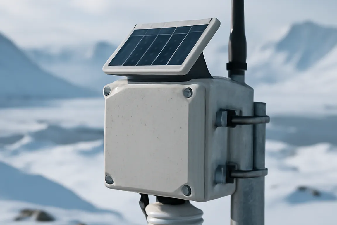
Each station also generally logs internal diagnostics such as battery voltage, modem signal strength, and enclosure temperature, so that a sudden deviation from expected values can trigger a maintenance flag before the unit fails outright. Field technicians have increasingly added vibration sensors to some installations to help detect ice floe movement near river crossings, a promising complement to purely thermal measurements.
Ice road monitoring: thickness, temperature, alerts
Ice thickness remains the primary safety metric, yet direct measurement traditionally requires drilling or ground-penetrating radar. Some Nunavik routes now embed thermistor strings that record temperature gradients through the ice column at intervals along the crossing. When the temperature at the ice-water interface rises above a critical threshold for an extended period, an automated alert is generally issued to municipal dispatch centers. Operators often combine these readings with surface temperature estimates from satellite imagery to get a broader picture of bearing capacity across an entire crossing rather than relying on a handful of point measurements alone.
The following table summarizes the general logic of alert thresholds used across this kind of network:
| Parameter | Yellow Alert (caution) | Red Alert (high risk) | Typical Response |
|---|---|---|---|
| Ice-water interface temp | Approaching threshold briefly | Above threshold for extended time | Increased monitoring |
| Surface melt pool coverage | Limited, localized | Widespread across segment | Restricted or closed route |
| Wind chill adjusted temp | Elevated daytime readings | Sustained elevated readings | Same-day reassessment |
These thresholds are generally reviewed periodically by joint technical committees that incorporate feedback from both scientific staff and experienced local drivers, since the two perspectives often catch different kinds of risk.
GPS and personal satellite communication for isolated travel
Personal locators such as Garmin inReach and ZOLEO devices transmit position reports at regular intervals while allowing two-way text messaging via satellite. Some of these units can integrate with community mapping layers that display the most recently known ice-road status. Battery life under typical winter use generally covers several days to roughly two weeks depending on usage intensity, and units are usually built to tolerate brief immersion or heavy snow exposure. Many models also log ambient temperature and barometric pressure, providing supplementary data points that can help fill gaps between fixed weather stations in areas with sparse coverage.
Tip: A personal satellite communicator works best as part of a layered safety plan, not as a stand-alone solution. Pair it with a filed float plan, a charged VHF handheld, and a realistic understanding of how long help might take to arrive on a given route.
How data is shared with communities in real time
A central coordination point, often based in Kuujjuaq, generally aggregates readings from the network of stations and formats them for multiple output channels. A lightweight web dashboard accessible over low-bandwidth satellite internet is a common approach, alongside SMS bulletins that push concise updates, such as temperature, wind chill, and road status, to registered phones. Several communities have installed public signs at trailheads that display the most recent alert level using simple color-coded icons, a low-tech but effective solution for residents without a smartphone or reliable data plan.
Community feedback collected informally through local networks suggests that a meaningful share of residents adjust their travel plans based on these bulletins when conditions are marginal, though the exact proportion varies by community and by how recently the local signage or app has been updated.
Use cases: hunters, snowmobilers and road professionals
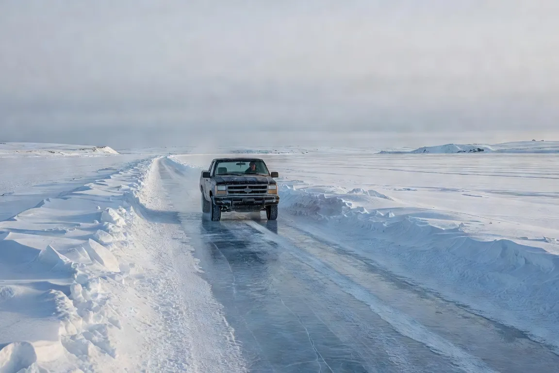
Hunters participating in the annual spring migration often travel considerable distances from their home communities. Real-time wind and visibility data help them decide whether to cross pressure ridges before deteriorating conditions set in. Snowmobile clubs in some communities maintain shared group communication that incorporates station alerts, allowing members to reroute collectively when conditions change unexpectedly. Road professionals responsible for freight convoys use the same data streams to schedule departures during the coldest overnight hours when ice strength generally peaks.
Typical planning criteria used by experienced travelers include:
- Checking the most recent alert level for the specific crossing planned
- Confirming wind forecasts, since sustained wind is a leading factor in rapid ice degradation
- Carrying a satellite communicator and informing someone of the planned route
- Being willing to delay or reroute a trip when conditions are marginal, rather than pushing ahead on a fixed schedule
The Goose Break traditions among Cree and Inuit communities illustrate how real-time alerts have become integrated into seasonal travel planning without displacing longstanding knowledge of ice behavior passed down through generations of hunters and elders.
Costs and accessibility of these technologies for individual use
Entry-level personal satellite messengers are generally priced in the range of a few hundred dollars, with modest annual service plans on top of the hardware cost. Fixed institutional weather stations represent a considerably larger investment, generally in the range of several thousand dollars once installation and calibration are included, which is why they are usually funded by municipalities, regional organizations, or partnerships with local economic actors rather than by individuals.
| User Category | Typical Cost Level | Common Funding Source |
|---|---|---|
| Individual hunter | A few hundred dollars a year | Personal budget, sometimes subsidized |
| Municipal freight operations | Moderate ongoing cost | Impact-benefit agreements |
| Regional government stations | Substantial investment | Federal climate-adaptation grants |
Several regional cooperatives and community programs offer subsidized access to satellite communicators for hunters who might otherwise find the ongoing subscription cost a real barrier, though the scale and availability of such programs differ from one community to another.
The role of municipalities and local organizations in deployment
Regional governments and community organizations generally coordinate station placement through joint technical committees. Local wildlife management boards contribute knowledge of traditional travel corridors, helping ensure sensors are sited where hunters actually cross rather than solely along the main winter road network. Training programs that certify local residents as station technicians create local employment while reducing dependence on flying in specialists from the south for every repair. Funding for this kind of infrastructure generally comes from a mix of federal climate-adaptation grants and contributions from economic actors operating in the region under impact-benefit agreements.
This collaborative structure also helps address a subtler challenge: deciding where a limited number of stations will deliver the most safety benefit. Placing every station along the most heavily trafficked route might seem obvious, but wildlife boards and experienced guides often point out that some of the riskiest crossings are the less-traveled ones used seasonally by a smaller number of hunters, where a single incident could go unnoticed for far longer without any monitoring at all.
Current limitations: coverage, power supply, maintenance
Despite progress, meaningful gaps persist. A large share of mapped winter trails still lie beyond the practical range of an active weather station, leaving long stretches without direct measurement. Solar charging can fail during extended cloudy periods in December and January, forcing some units to rely solely on battery reserves for days at a time. Corrosion from salt spray affects coastal installations more than inland sites, requiring more frequent component replacement. The guide to offline digital apps for the Far North notes that many travelers still carry paper maps as a backup when electronic systems experience outages lasting several hours or more.
Common mistake: Assuming a weather station’s last reported reading still reflects current conditions. A gap of even a few hours in a fast-changing situation can mean the difference between an accurate picture and a dangerously outdated one.
Additional constraints include a genuinely limited pool of certified calibration technicians across the region, and the logistical difficulty of transporting replacement parts outside of the brief summer sealift window, which can leave a failed remote unit offline for months at a time. This reality is one more reason why traditional knowledge and direct observation remain essential rather than optional, even as sensor networks expand.
Technology outlook for winter safety 2026-2030
Engineers are testing acoustic sensors that can detect ice cracking sounds at a distance, potentially providing earlier warnings than temperature-based models alone. Integration with drone-based radar surveys is also advancing, and the drone logistics in isolated communities initiative illustrates how similar aerial technology could eventually support faster thickness mapping along entire routes. Over the coming years, planners generally hope to expand continuous sensor coverage to a larger share of primary ice roads, paired with improving satellite constellations that should gradually reduce message latency. These incremental improvements should further narrow the gap between observed conditions and traveler awareness, provided maintenance funding and local training programs keep pace with hardware expansion.
Early pilot projects using machine-learning models trained on combined sensor and incident data show some promise for predicting breakthrough risk hours in advance, though this approach remains experimental and its reliability at scale has not yet been demonstrated across multiple full seasons. Sustained operating budgets beyond initial grant cycles, and a larger pool of trained local technicians, will likely matter more to the success of this technology over the next five years than any single sensor breakthrough.
Ultimately, the value of these systems lies less in any single dramatic innovation and more in the steady accumulation of small, reliable improvements: a slightly earlier alert, a slightly more accurate thickness estimate, a slightly faster repair after a failure. None of these individually transforms winter travel safety in the region, but together they meaningfully reduce the odds of a traveler being caught by surprise, which remains the underlying goal of the entire connected weather station effort in Nunavik and Eeyou Istchee.
Key takeaway: Sensor networks reduce but do not eliminate the need for experienced judgment on ice conditions.
Frequently asked questions
How does a connected weather station work in an arctic region?
A connected weather station combines sensors (temperature, wind, ice thickness for some models) with a transmission module that sends data to a central platform, often via satellite or cellular link depending on location. This data is then made available to communities and authorities in near real time.
What risks do ice roads present in Nunavik during winter?
Ice roads carry risks of subsidence, cracking and rapid variation in ice thickness depending on temperature and current conditions. A vehicle or snowmobile can get into trouble within minutes if conditions change without users being warned in time.
Can hunters and travelers check real-time weather data?
Yes, several communities provide weather data and road condition bulletins accessible via apps or local broadcast channels, when network coverage allows it. In areas without coverage, a personal satellite communicator remains the only reliable way to check certain critical information in real time.
What role do personal satellite communicators like Garmin inReach play?
Personal satellite communicators such as the Garmin inReach let users send messages, share their GPS position and trigger an SOS alert even with no cellular network at all. They are increasingly recommended as basic equipment for winter travel outside inhabited areas.
How are local communities alerted to dangerous conditions?
Alerts about dangerous conditions are generally broadcast by municipal or regional authorities through locally available channels (community radio, social media, posted notices), complementing the technical data from connected stations. How quickly alerts spread nonetheless depends on a reliable connection being available at the time.
Are these technologies affordable for individual use?
Basic equipment (a personal satellite communicator) remains affordable for individual use, with a purchase cost in the range of a few hundred dollars and a modest monthly subscription. Institutional connected weather stations represent a larger investment, generally carried by municipalities or regional organizations rather than individuals.